RockFLEET Assured Configuration
Configuration
The RockFLEET Assured system is supplied pre-configured for rapid installation and operation. If required, parameters within the Above Deck Unit can be changed locally using the BLE mobile app or remotely using the Cloudloop platform.
Note: All units are shipped with nmeaForwardEnabled set to false. This must be set to true using the mobile app or
Cloudloop Device Manager (CDM) for Chart Plotter communication to work.
Detailed RockBLOCK Pro A-PNT configuration
A-PNT feed to the Chart Plotter
Enabling the NMEA sentences from the RockBLOCK Pro A-PNT module within the Above Deck Unit displays the A-PNT position as a waypoint and the GNSS position as a "ghost" vessel on the Chart Plotter when the settings are configured correctly.
JAMMING and SPOOFING detection and display settings.
These settings enable configuration of the Jamming and Spoofing alarm trigger conditions as well as the displayed graphics. The boundary for spoof detection always scales with the A-PNT Estimated Position Error (EPE) so that changes in the level of this error do not cause false alarms.
Alarm Suppression is ONLY possible by parameter adjustment. It is clear that if false positives are occurring or if the alarm is triggering too often then adjustment of the parameters below can reduce annoyance and tune the sensitivity to an appropriate level.
- "Chart": Allows positions to be plotted on a compatible Chart Plotter, such as the Raymarine AXIOM® 9.
- "epeScale": - Multiplier that sets the boundary (second circle) for tripping the SPOOF detection alarm, set from
0.5-10.0 - "positionCompareTimer": - Time the GNSS position needs to be outside the boundary(epescale * epe) before the SPOOF detection alarm is triggered, set from
0-300seconds. - "utcDifferenceLimit": - Affects the threshold before time spoof checking starts the timer, set from
2-10seconds - "utcDifferenceTimer": - Affects the amount of time the time difference threshold needs to be exceeded before alarming, set from
0-300seconds. - "positionValidityTimer": - Affects the amount of time GNSS fixes are INVALID or JAMMED before alarming, set from
0-300seconds.
"errorCircle": - Enables or disables the display of the A-PNT Estimated Position Error (inner circle), settrueto display orfalseto hide.
- "errorLimitCircle": - Enables or disables the display of the outer circle, set
trueto display orfalseto hide.
- "errorLimitCircle": - Enables or disables the display of the outer circle, set
- "testingAllowed": - set
trueto enable the Connect IoT app to impose GNSS position changes for local test and demonstration purposes. Setfalseto disable.
- "epeScale": - Multiplier that sets the boundary (second circle) for tripping the SPOOF detection alarm, set from
Configuring the Raymarine AXIOM® 9 Chart Plotter
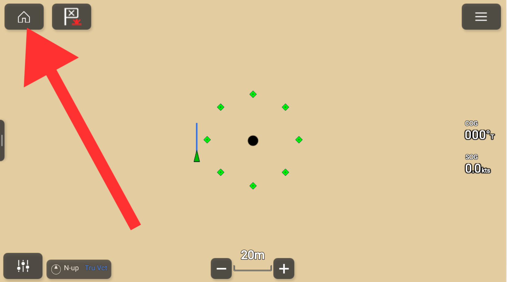
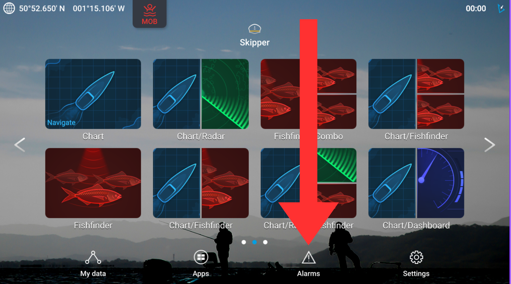
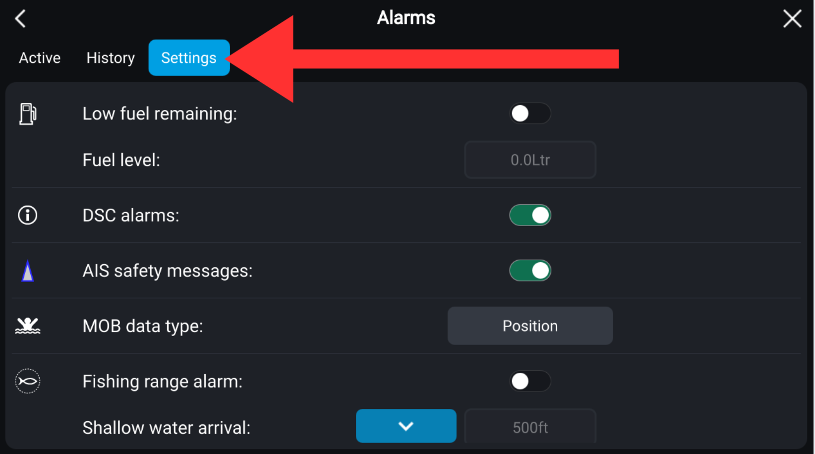
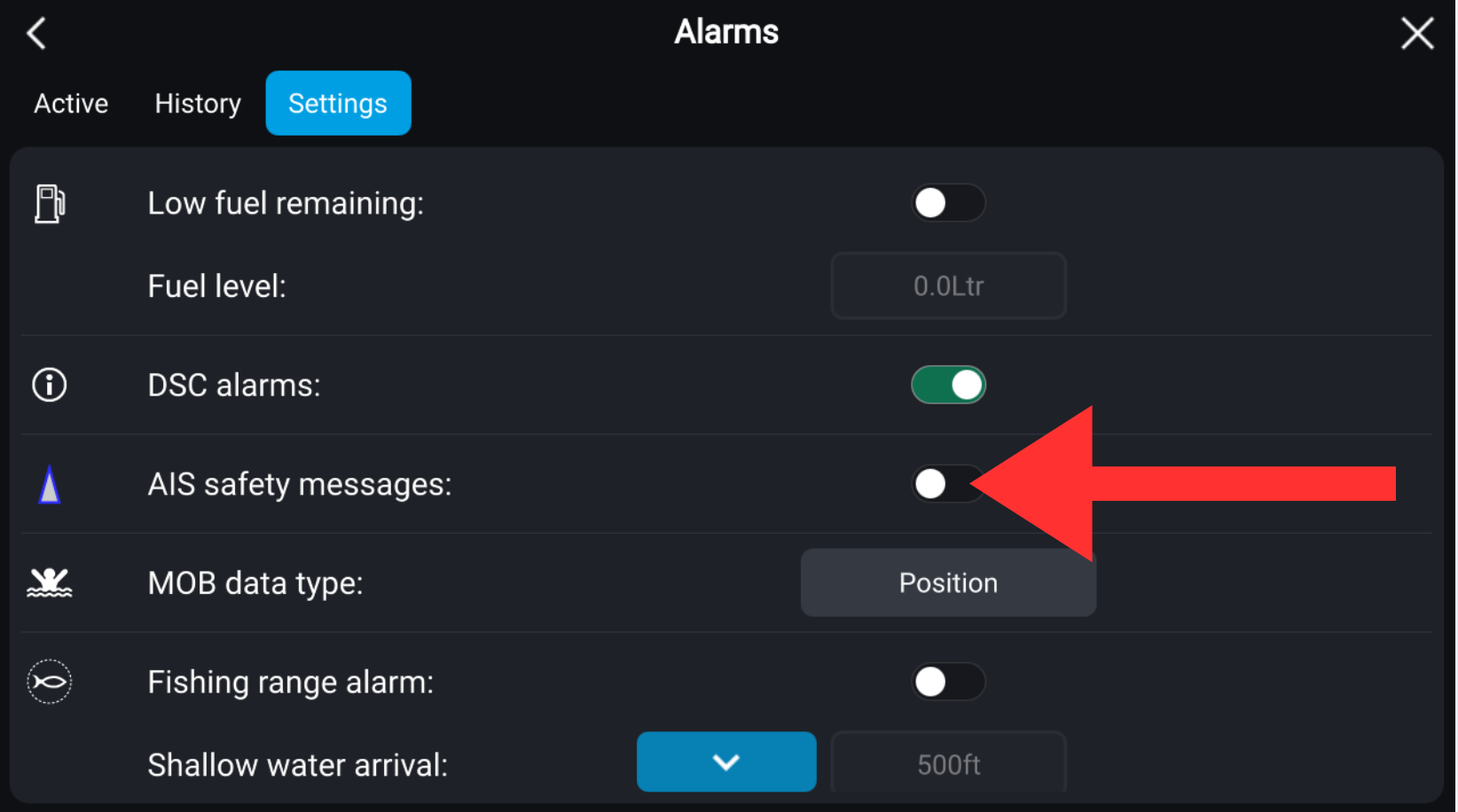
Enable alarms by switching AIS safety messages on. Disable the alarms by switching the messages off. See the images below.
 |  |
|---|---|
 |  |
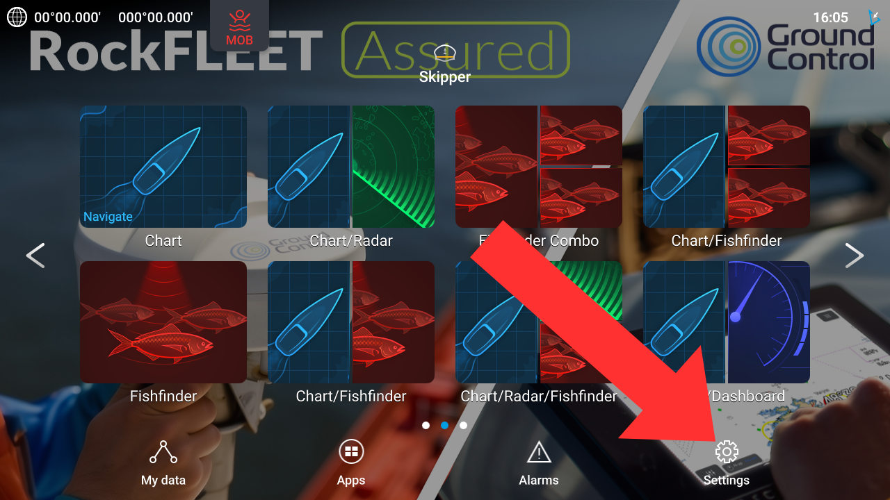
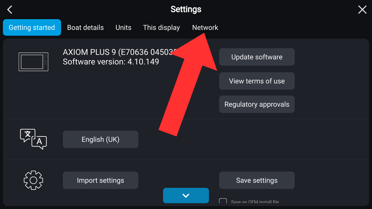
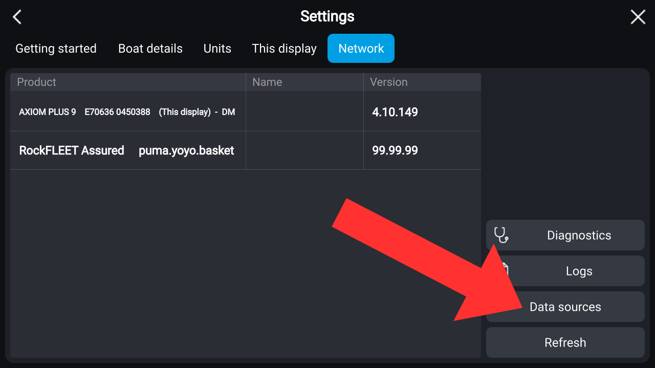
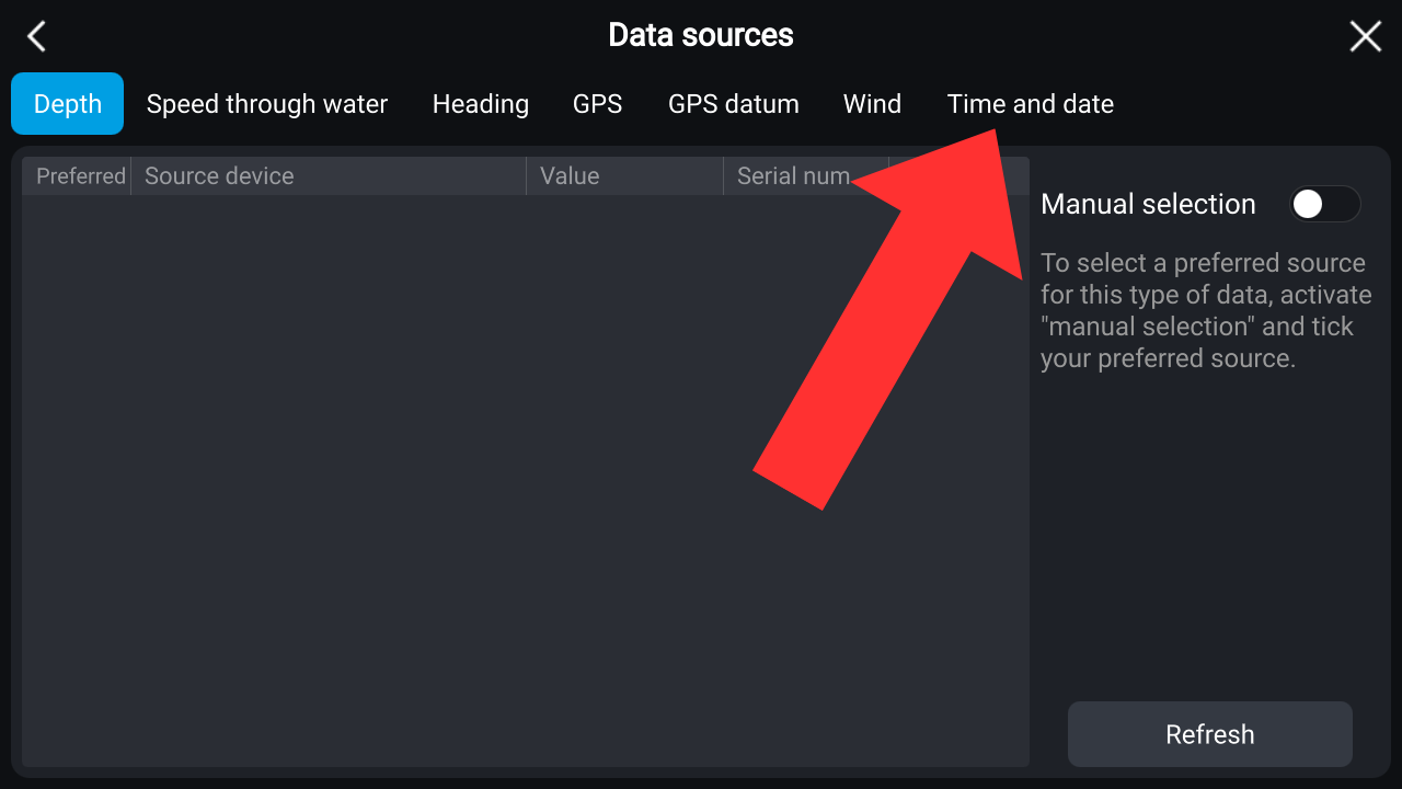
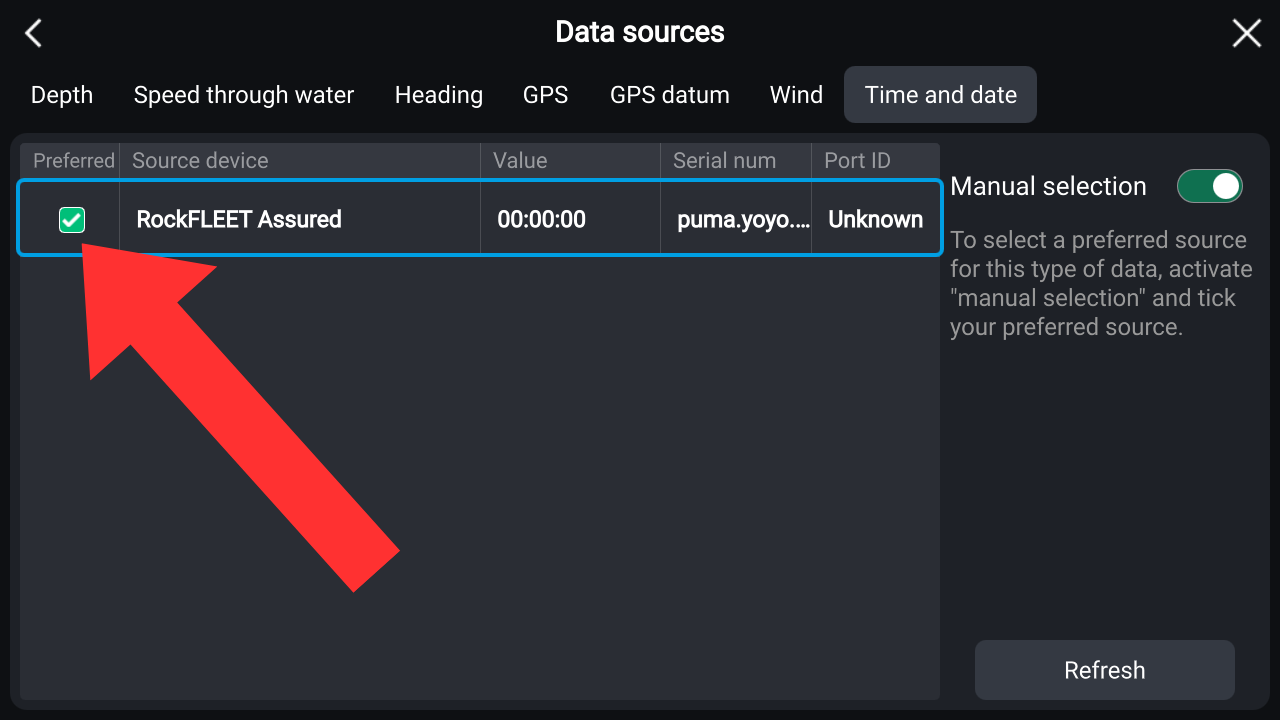
Set time source to RockFLEET Assured. See below.
 |  |  |
|---|---|---|
 |  | |
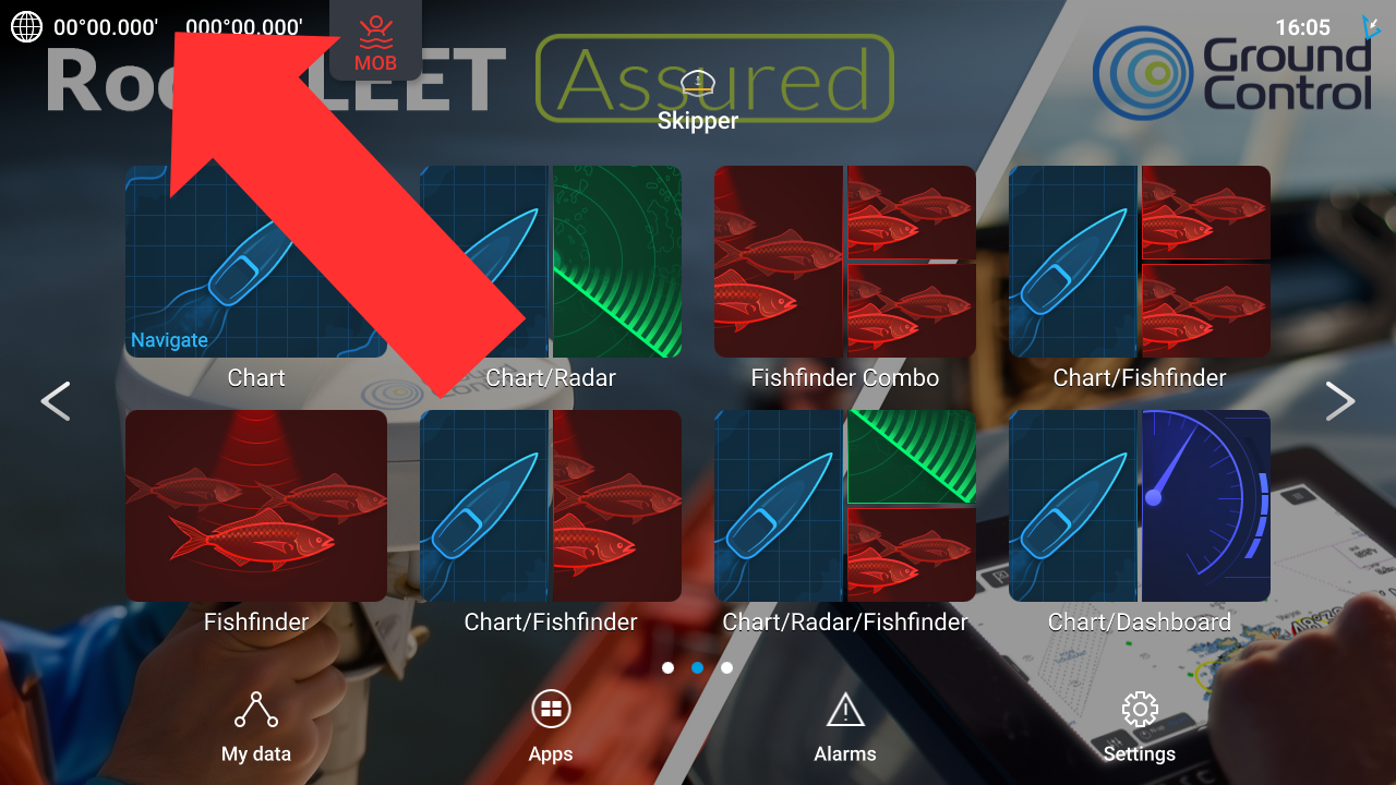
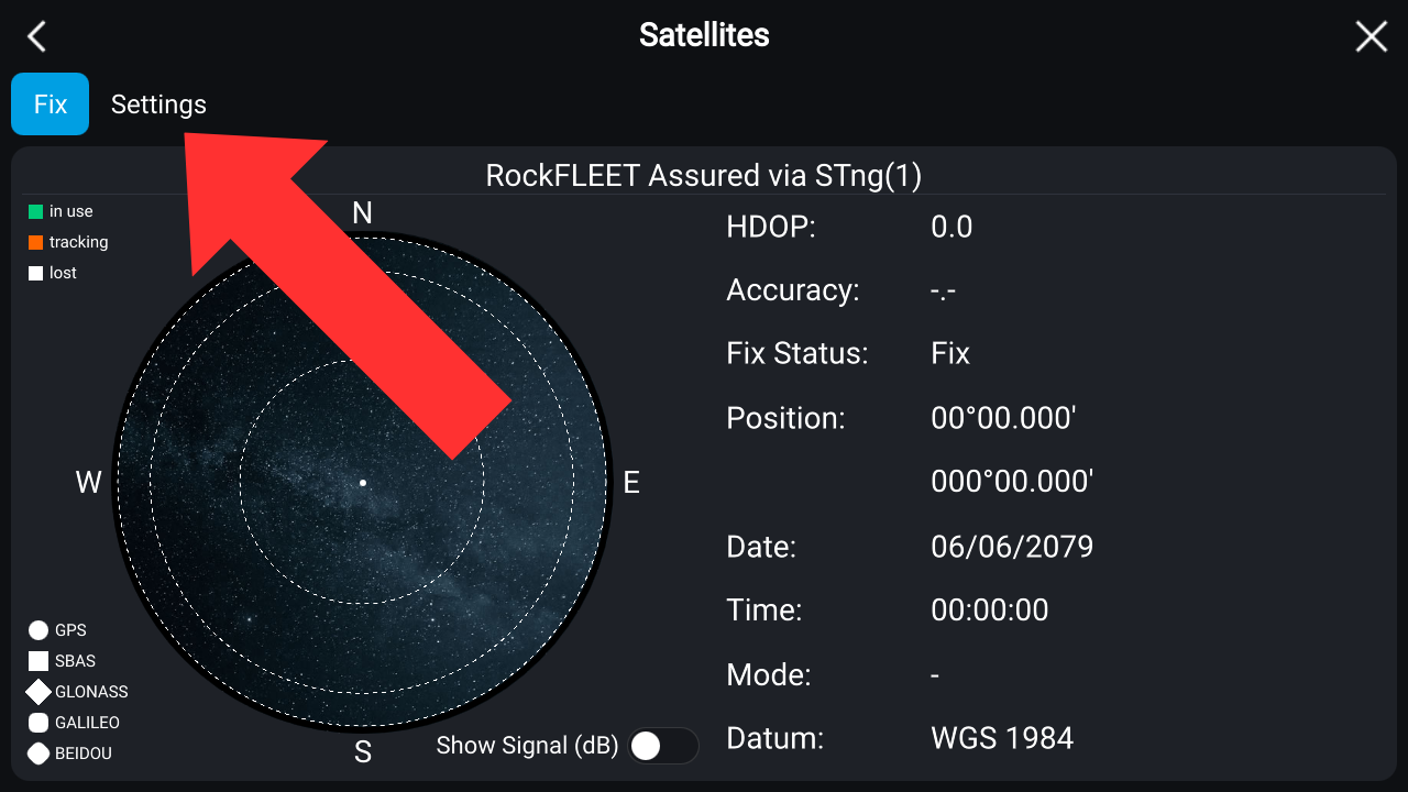
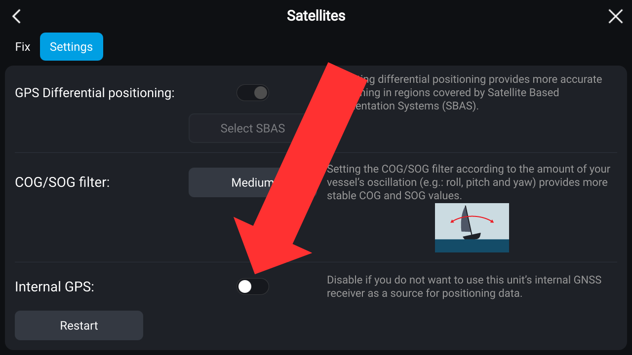
Turn off the Chart Plotter's internal GPS. See below.
 |  |
|---|---|
 |
RockBLOCK Pro A-PNT configuration (NMEA 2000 version)
The following user configuration example shows the required settings for the NMEA 2000 version only.
Download here in ready to deploy state. i.e. without commentary
Details on user.cfg deployment can be found here
{
  "Serial":{
    "Enabled":true,
    "mode":"RS4XX_FULL",
    "baud":115200,
    "parity":"NONE",
    "bits":8,
    "stop":1
  },
  "BLE":{
    "Enabled":true,
    "connectionTimeout":300
  },
  "GNSS":{
    "Enabled":true,
    "nmeaForwardEnabled":false,
    "reportInterval":900,             <-----SECONDS BETWEEN EACH POSITION REPORT MADE TO CLOUDLOOP
    "apntMode":"DYNAMIC",             <-----DYNAMIC FOR BETTER TRACKING WHILE MOVING
    "apntKalmanFilter":"MARITIME",
    "apntSensitivity":"HIGH",
    "apntPowerSaving":"FAST",
    "nmeaSentences":{
      "GNGGA":false,
      "GNRMC":false,
      "GPGGA":false,
      "GPRMC":false,
      "GPZDA":false,
      "PJLTPOS":false,
      "PJLTSTAT":false,
      "PJLTSVI":false,
      "PJLTVEL":false,
      "AISVDO":false
    },
    "apntFilterPosition":true,       <-----POSITION REPORT WILL USE THE POSITION WITH THE LOWEST EPE FROM THE LAST 20% OF SET REPORT INTERVAL
    "apntHot":false                  <-----WHEN FALSE THE A-PNT MODULE WILL ONLY BE POWERED 20 MINUTES BEFORE EACH POSITION REPORT
},
    "Sensors": {
      "Enabled": true
    },
    "IO": {
      "IOtype": "DIGITAL",
      "IOchans": [
        {
          "channelIndex": 1,
          "channelMode": "UNKNOWN",
          "filter": "HIGH",
          "hysteresis": 0.1,
          "threshold": 1.5,
          "reportCoV": 0.0,
          "reportPeriod": 0
        },
        {
          "channelIndex": 2,
          "channelMode": "UNKNOWN",
          "filter": "HIGH",
          "hysteresis": 0.1,
          "threshold": 1.5,
          "reportCoV": 0.0,
          "reportPeriod": 0
        },
        {
          "channelIndex": 3,
          "channelMode": "UNKNOWN",
          "filter": "HIGH",
          "hysteresis": 0.1,
          "threshold": 1.5,
          "reportCoV": 0.0,
          "reportPeriod": 0
        },
        {
          "channelIndex": 4,
          "channelMode": "UNKNOWN",
          "filter": "HIGH",
          "hysteresis": 0.1,
          "threshold": 1.5,
          "reportCoV": 0.0,
          "reportPeriod": 0
        }
      ]
    },
    "SleepMode": "NONE",
    "LEDS": {
      "Enabled": true
    },
    "Imt": {
      "defaultTopic": 244,
      "defaultTTL": 86400,
      "startupEventEnabled":true
    },
    "BUZZER": {
      "Enabled": true
    },
    "SVI": {
      "reportDuration": 0,
      "reportTopic": 313,
      "reportInterval": 0
    },
    "Chart": {
      "epeScale": 1.0,                   <-----EPE SCALE IS SET TO 1.0, THEREFORE ALARM IS TRIGGERED IF GNSS AIS TARGET IS (1.0 x EPE) AWAY FROM A-PNT POSITION
      "positionCompareTimer": 10,        <-----SET TO 10, MEANS THAT ALARM WILL TRIGGER EVERY 10 SECONDS IF THE GNSS TARGET WAS OUT OF RANGE
      "utcDifferenceLimit": 0,
      "utcDifferenceTimer": 0,
      "positionValidityTimer": 0,
      "errorCircle": true,               <-----ENABLES THE ACTUAL EPE CIRCLE TO APPEAR ON THE CHART PLOTTER
      "errorLimitCircle": false          <-----ENABLES THE SCALED EPE CIRCLE TO APPEAR ON THE CHART PLOTTER
    }
  }
RockBLOCK Pro A-PNT configuration (NMEA 0183 version)
The following user configuration example shown below indicates the required settings for the NMEA 0183 version only.
Download here in ready to deploy state. i.e. without commentary
Details on user.cfg deployment can be found here
  {
    "Serial": {
      "Enabled": true,
      "mode": "RS4XX_FULL",     <-----SERIAL SETTINGS SET TO WORK FOR RS422 AT 38400 BAUD
      "baud": 38400,
      "parity": "NONE",
      "bits": 8,
      "stop": 1
    },
    "BLE": {
      "Enabled": true,          <-----BLE NEEDS TO BE ON FOR APP
      "connectionTimeout": 300
    },
    "GNSS": {
      "Enabled": true,
      "nmeaForwardEnabled": true,       <-----GNSS & NMEA FORWARDING HAS TO BE ENABLED FOR THE CHART PLOTTER TO FUNCTION
      "reportInterval": 900,            <-----SECONDS BETWEEN EACH POSITION REPORT MADE TO CLOUDLOOP
      "apntMode": "DYNAMIC",            <-----DYNAMIC FOR BETTER TRACKING WHILE MOVING
      "apntKalmanFilter": "MARITIME",
      "apntSensitivity": "HIGH",
      "apntPowerSaving": "FAST",
      "nmeaSentences": {
        "GNGGA": false,
        "GNRMC": false,
        "GPGGA": true,                   <-----GPGGA NEEDS TO BE ON
        "GPRMC": true,                   <-----GPRMC NEEDS TO BE ON
        "GPZDA": false,
        "PJLTPOS": false,
        "PJLTSTAT": false,
        "PJLTSVI": false,
        "AISVDO": true                   <-----WHEN TRUE THE AIS MESSAGES WILL BE SENT FOR THE EPE SCALE CIRCLE TO BE DISPLAYED ON THE CHART PLOTTER
      },
      "apntFilterPosition": true,        <-----POSITION REPORT WILL USE THE POSITION WITH THE LOWEST EPE FROM THE LAST 20% OF SET REPORT INTERVAL
      "apntHot": true                    <-----WHEN FALSE THE A-PNT MODULE WILL ONLY BE POWERED 20 MINUTES BEFORE EACH POSITION REPORT
    },
    "Sensors": {
      "Enabled": true
    },
    "IO": {
      "IOtype": "DIGITAL",
      "IOchans": [
        {
          "channelIndex": 1,
          "channelMode": "UNKNOWN",
          "filter": "HIGH",
          "hysteresis": 0.1,
          "threshold": 1.5,
          "reportCoV": 0.0,
          "reportPeriod": 0
        },
        {
          "channelIndex": 2,
          "channelMode": "UNKNOWN",
          "filter": "HIGH",
          "hysteresis": 0.1,
          "threshold": 1.5,
          "reportCoV": 0.0,
          "reportPeriod": 0
        },
        {
          "channelIndex": 3,
          "channelMode": "UNKNOWN",
          "filter": "HIGH",
          "hysteresis": 0.1,
          "threshold": 1.5,
          "reportCoV": 0.0,
          "reportPeriod": 0
        },
        {
          "channelIndex": 4,
          "channelMode": "UNKNOWN",
          "filter": "HIGH",
          "hysteresis": 0.1,
          "threshold": 1.5,
          "reportCoV": 0.0,
          "reportPeriod": 0
        }
      ]
    },
    "SleepMode": "NONE",
    "LEDS": {
      "Enabled": true
    },
    "Imt": {
      "defaultTopic": 244,
      "defaultTTL": 86400,
      "startupEventEnabled":true
    },
    "BUZZER": {
      "Enabled": true
    },
    "SVI": {
      "reportDuration": 0,
      "reportTopic": 313,
      "reportInterval": 0
    },
    "Chart": {
      "epeScale": 1.0,                   <-----EPE SCALE IS SET TO 1.0, THEREFORE ALARM IS TRIGGERED IF GNSS AIS TARGET IS (1.0 x EPE) AWAY FROM A-PNT POSITION
      "positionCompareTimer": 10,        <-----SET TO 10, MEANS THAT ALARM WILL TRIGGER EVERY 10 SECONDS IF THE GNSS TARGET WAS OUT OF RANGE
      "utcDifferenceLimit": 0,
      "utcDifferenceTimer": 0,
      "positionValidityTimer": 0,
      "errorCircle": true,               <-----ENABLES THE ACTUAL EPE CIRCLE TO APPEAR ON THE CHART PLOTTER
      "errorLimitCircle": false          <-----ENABLES THE SCALED EPE CIRCLE TO APPEAR ON THE CHART PLOTTER
    }
  }