Geofencing Example
Screenshots in this document were captured from a non-standard account. Interface colours in standard accounts may differ, but all functionality remains the same.
Geofencing Example: Gulf Princess Voyage
Consider the Gulf Princess, travelling from Djibouti to Galle in Sri Lanka. During the voyage, the tracker's behaviour needs to be updated to reflect changing conditions. Here, we demonstrate how to configure geofence behaviours and messages based on different voyage segments.
Embarkation from Djibouti
In the Behaviours tab:
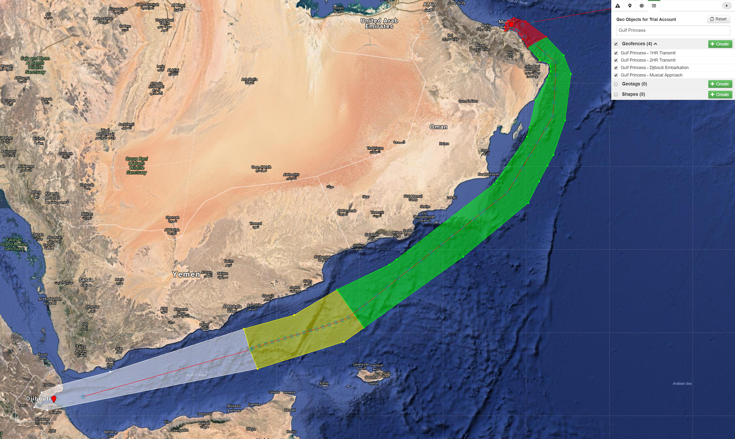
- Select the geofence for the Gulf Princess' embarkation from Djibouti (highlighted in white).
- Set the condition to alert first responders if the Gulf Princess moves outside of the geofence.
In the Messages tab:
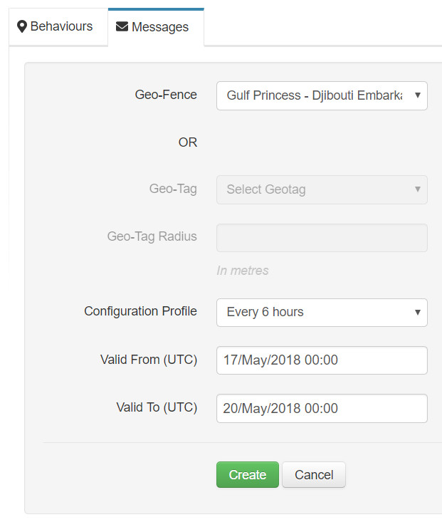
- Select the geofence for the embarkation from Djibouti.
- Configure the tracker to send a position report every 6 hours while inside the geofence.
- Set the validity period for the configuration.
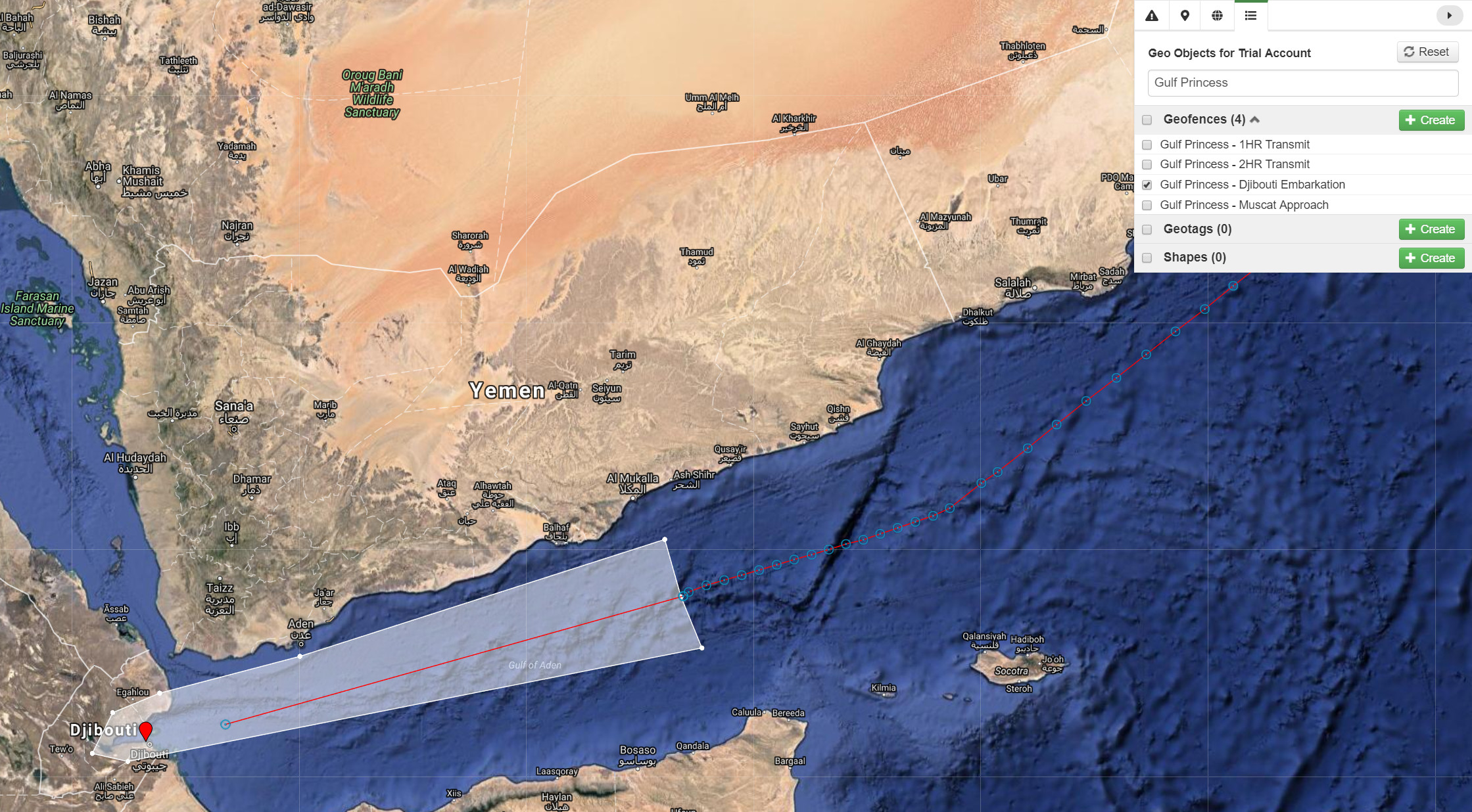
Send Configuration Messages
To set the position tracking interval to six hours while inside the Djibouti-Embarkation geofence, send a previously defined configuration profile. For details on creating configuration files, see Config Profiles.
The expected timeframe for the Gulf Princess to be within this geofence is from May 17th, 2018, 00:00 UTC to May 20th, 2018, 00:00 UTC—approximately three days.
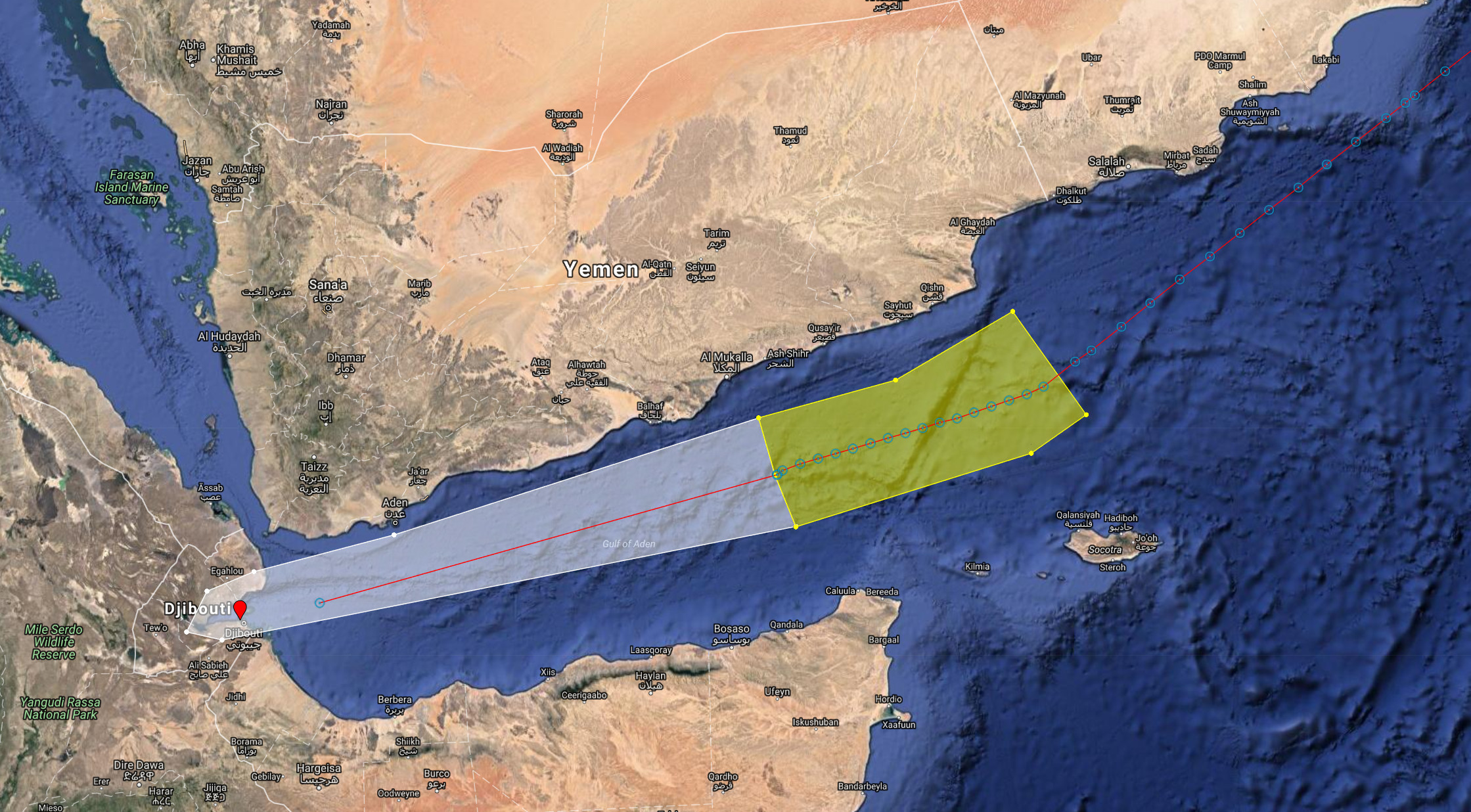
1 Hour Transit Area
Next, we'll define the messages and behaviour for the yellow geofenced area labelled "1 Hr Transit." In this high-risk zone, the position tracking interval is set to 1 hour due to heavy traffic and piracy concerns.
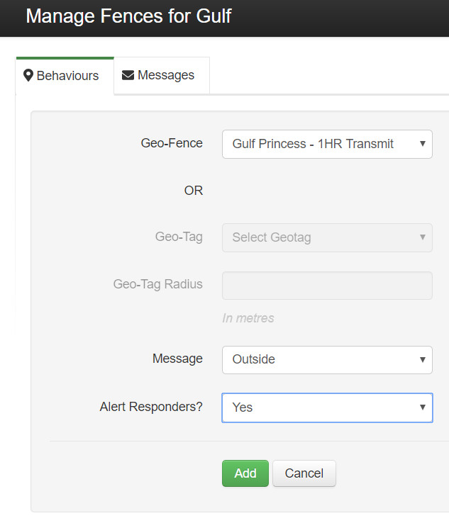
To alert first responders if the Gulf Princess strays outside of the 1 Hour Transmit geofence:
- Select the 1 Hour Transmit geofence.
- Set the condition to "Outside" (an alert will be sent when the tracker leaves the geofence).
- Choose to alert first responders.
Sending Configuration for 1-Hour Tracking
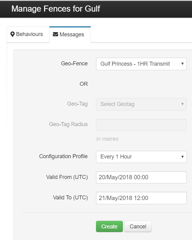
To configure 1-hour position tracking while in the 1 Hour Transmit geofence, use a configuration profile and specify the validity period. The expected timeframe is from May 20th, 2018, 00:00 UTC to May 21st, 2018, 12:00 UTC—approximately one and a half days.
In the Messages tab:
- Select the geofence of interest.
- Choose the appropriate configuration profile (see Config Profiles.
- Set the validity period.
Handling Delays: Geofence and Alert Considerations
If the Gulf Princess does not reach the 1 Hour Transmit area within the defined time, no alert will be sent until it crosses into the defined geofence and a state change is registered.
This same methodology can be applied to the rest of the voyage:
- Green Geofence: Set to a two-hour transmission interval for a relatively uneventful segment.
- Red Geofence: Set to a 30-minute interval due to heavy port traffic at Djibouti.
Geofences and Battery Conservation
When a tracker is connected to mains power (e.g., RockFLEET, RockAIR), both GPS and Iridium antennas remain active. This results in minimal latency between the first SBD transmission, a ping indicating a configuration change, and a second SBD transmission.
For example, when the Gulf Princess crosses from the white "Embarkation" geofence into the yellow "1 Hr Transmission" geofence, the new position is transmitted. However, no new instructions are issued until this current position has been processed. Once a location change is detected, an alert is sent, and the new instructions are downloaded immediately.
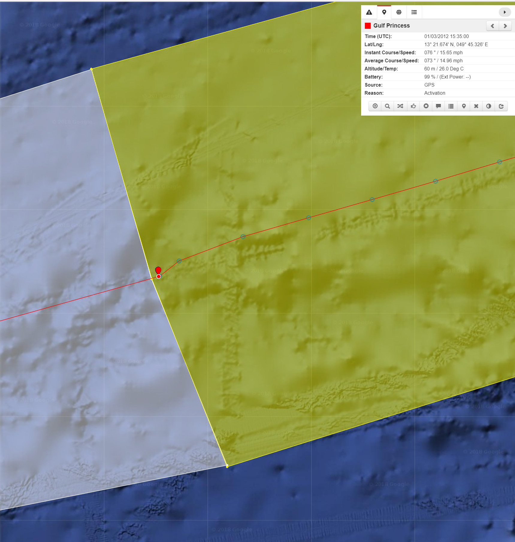
When using battery-powered trackers (e.g., RockSTAR), the tracker shuts down between SBD transmissions to conserve battery power. As a result, there is a longer latency period between crossing a geofence and receiving updated directions or messages.
Thus, when designing geofences for battery-powered trackers, it is important to account for the distance travelled during the latency period between SBD transmissions.